Singapore may be a concrete jungle in many respects, but it’s not difficult to find patches of greenery that provide wonderful escape from the city, while posing various levels of challenges for a range of fitness and adventure levels.
Trekking in the Central Catchment and Bukit Timah Nature Reserves
Keep moving and keep exercising. Trekking is a great way to keep active while taking in nature, exploring areas in Singapore and staying fit.
The Tree Top Walk (Easy/level 1/5); The MacRitchie Trail (Easy/level 1/5)
Let’s start here. Head out to the Tree-top Walk from Windsor Forest in Upper Thomson. You should be able to complete the comfortable circuit in about two hours.
Advertisement
Very popular with runners, the MacRitchie Trail gets crowded on weekends. You can start from the Windsor Forest and cover it in about an hour. As you reach the final 1.3km mark, you’ll be treated to glimpses of the beautiful reservoir between the trees in rich shades of jade green and cobalt blue.
You can also choose the longer way to reach MacRitchie via the SICC golf course route.
From the Ranger’s Station (the very prominent water-cooler-refill area/restrooms), continue walking on the rocky trail and then make a choice: Head right if you would like to visit the Bukit Timah Nature Reserve (6.1km) or head straight through a pretty boardwalk wooded area until you reach the SICC grounds.
This part after the boardwalk is the muddiest and should ideally be avoided if there was rain the day before. Follow the signs obediently as you’ll be walking along the fringe of the golf course for a fair bit before you reach MacRitchie Reservoir.
The Bukit Timah Nature Trail (Comfortable/level 2/5)
Taking the trek to the Bukit Timah Nature Reserve, you’d have a peaceful walk in the Central Catchment Reserve because relatively fewer runners and trekkers take this route.
The gradient gets steeper towards the end of the trail as you meet the wide part of Rifle Range Road, walking past ST Engineering and the Rifle Range Camp. Then proceed onto the highway bridge (over the PIE) for a bit before you continue on Rifle Range Road towards Temasek Club.
There is an interesting choice on the highway bridge after the PIE — look out on the right for a descent opposite Lampost 89 that will take you towards the Belukar cycle tracks and Pipeline Trail.
I was astounded when I first came across this vast pipeline stretch. It felt like I had stumbled onto Singapore’s biggest trekking secret. Following the pipelines on your right will lead you to the base climb starting point to Bukit Timah Hill.
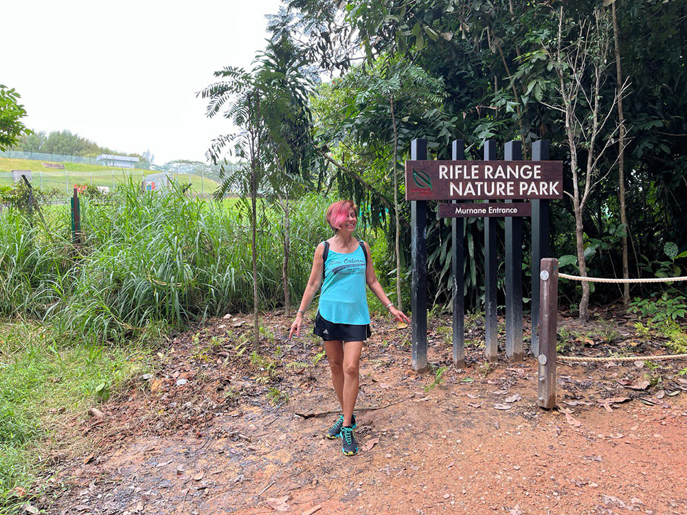
If you go left and ascend the path that joins Rifle Range Road, you’ll be facing the Murnane Reservoir. Continue on the Murnane entry to the Rifle Range Nature Park. You would have trekked about 8km. You may access the rail corridor from here and head on to the Bukit Timah Nature Reserve.
Scaling Bukit Timah Hill (Manageable 3/5) and descent via steps (Difficult 4/5)
Perhaps on another day, scaling Bukit Timah Hill (163.63 metres) could be your goal. It is advisable to scale the Hill first because you’ll need the energy for the rest of the trip.
Start at the Visitors’ Centre. The road up the hill has a steep incline. But it is a shady 1.3km walk among the dipterocarp trees. You can also choose alternative routes up the hill: The South View/Kruing Path. This breaks the incline and enables you to take in beautiful flora and fauna as you climb to the top.
When you reach the base of the summit, choose the gentler gradient of the winding road up or, if you feel fit, walk or run up the 155 or so steps to the summit.
For the descent to the Dairy Farm Park, take the Renggang Path (difficult because of the steep knee-high steps) or Cave/Catchment Path (difficult because of the steep steps and up-and-down climbs).
An interesting bit of history is hidden here; look out for two caves built by the Japanese soldiers during the war tucked into the hillside.
Once you have descended, head for the Wallace Trail and on to the Dairy Farm Park. (If you have the time, explore the Wallace Centre and learn about dairy production).
Here one is beset with options: Continue on to the Zhenghua Park from the Dairy Farm Park; go to the end of the Wallace Trail and head out to the Singapore Quarry from Carpark A, or take the undulating Pipeline Trail back to Rifle Range Road.
Quarry Days (Easy/level 1/5)
Two quarries in the area you can explore would be the Hindhede Quarry and Singapore Quarry.
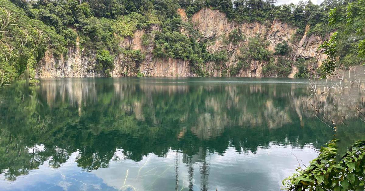
From the Visitor Centre of Bukit Timah Hill, enjoy a 10-minute stroll on the boardwalk to the look-out of the tranquil, turquoise Hindhede Quarry. If your grandchildren are with you, they’ll enjoy the Children’s Playground in Hindhede Park.
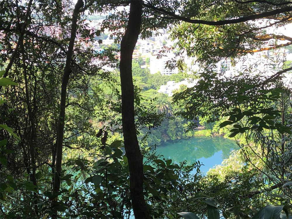
To access the Singapore Quarry, traverse 1.8km from Carpark A behind Hillview Station. Fewer people take this route and your reward is the serene quarry. If you choose to start from the Rail Mall, look for Jalan Asas and hang right; the entrance is tucked away at the end of the playground.
The Mandai T15 Trail and Chestnut Nature Park (Comfortable/level 2/5)
I promised you different trails in the Central Catchment Area.
The Mandai T15 Trail is a haven for mountain bikers. So as you walk on this clay shared track, be on the lookout for bikers. However, they are polite and would announce their arrival with a “Bike!”.
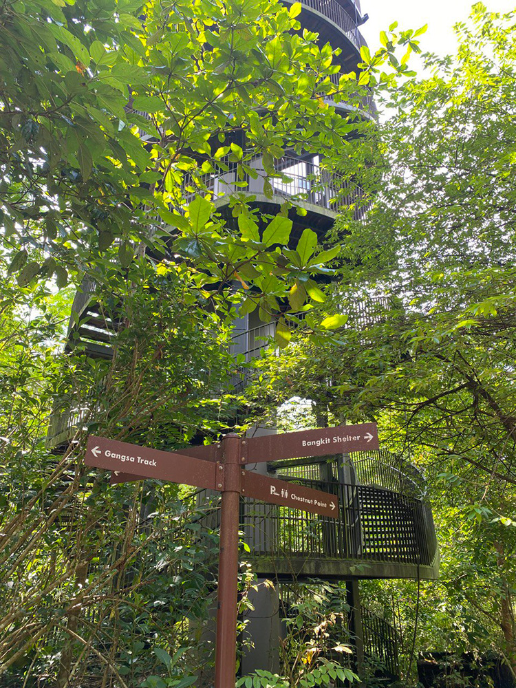
You can approach T15 from Zhenghua Park or you can begin your trek at the Chestnut Nature Park. One way would be to take the LRT at Bukit Panjang and get off at Pending. Turn left onto Bangkit Road when you exit the station and walk along until you see a condo. Across the condo is a path leading to the sign “Zhenghua Park”.
At the sign, take a right and walk under the PIE to Chestnut Nature Park, Singapore’s largest nature park. Check out the Observation Tower and Training Shed.
That would be your starting point on the T15. Take the Gangsa Track. You’ll find yourself walking in the forests beside the PIE and SLE and may chance upon sambar deer and macaque monkeys.
You can also access the T15 from the Central Catchment Park Connector entrance tucked away at the junction of Mandai Road and Mandai Lake Road.
Check out the picturesque Upper Seletar Reservoir trails before you enter the forest. Or take along a picnic basket and sit by the water at the picnic benches provided, savouring lunch before the hike.
The Clementi Forest Substitute Adventure (Comfortable/level 2/5 to Difficult/level 4/5)
As you venture along Kheam Hock Road from Lornie Road and after passing the Bukit Brown Cemetery, make a left to enter the forest the moment you see a “Caution enter at your own risk” sign.
Enjoy the canopied walk. You’ll pass a dilapidated house that has some semblance of occupation. Then the biggest surprise looms right up in front of you. Stay awhile and take in the atmosphere of the beautiful, tall, formal-glove-like trees (similar to those found in the Clementi Forest).
After this the walk progresses to level 3/5 as you meander down a narrow path; then level 4/5 as you pass the stream and are confronted with a water-logged path. You can return the way you came.
If the ground is dry and you make it across, you are well on your way to ascending the stairs to the famous Chinese Temple (Sin Heng San Teng Tua Pek Kong; built in the 1950s). You then exit onto lower Kheam Hock Road.
The Clementi Forest (Treacherous/level 5/5)
I deliberated whether to include this trek. It is the one that has earned my level 5/5 grading. I wouldn’t recommend it but am listing it here because I would like to share my experience.
The forest is not meant for hiking as yet. There are no marked trails. My husband and I followed the online documented accounts of those who had bravely ventured forth. We started at bus stop 12109 opposite Ngee Ann Poly.
The vague paths are narrow, muddy (especially if it has rained the day or two before) and slippery. It’s a grab-anything-you-can-hold-on-to experience. Our shoes were caked in mud (hubby threw his away when we finished) and I washed mine in a drain with the running water from a stream at Sunset Way.
We trekked in a huge drain (almost twice our height) before scaling an extremely slippery slope to get to the train tracks of the now defunct Jurong line. Although triumphant that we made it, hubby slipped three times, cutting his lip on one.
My victory was pulling my shoe out of the mud at the start and finishing off with a contusion near my knee (it hurt for two months) as I underestimated my jump drop onto the train tracks.
That evening, I read in the news that an SCDF team had to rescue a teenager with a dislocated leg. The team found another way out (to the Rail Corridor) with their ‘patient’ on a stretcher as it was hard enough on the way in from Sunset Way trekking 900m in the dark before rescuing the injured party.
The area is known to have amazing flora and fauna. Just days before this I read about three ladies who were lost in the forest looking for the Dienia ophrydis, an orchid presumed to be extinct. The internet connection is weak and at times non-existent. They were finally found at 8pm.
I met a silver as I exited the forest that day. He asked me about the trek and I quipped: “It’s dangerous. Don’t go in alone. And don’t start your trek at 4 pm!”. He should wait until the Old Jurong Line Nature Trail is completed in stages from 2024.


