Summary:
- The 10km Rail Corridor South is an easy, accessible, mostly flat hiking trail lined with greenery, heritage landmarks like the restored Bukit Timah Railway Station, and multiple convenient MRT and bus access points, though one section is closed for renovation until July 2027.
- Amenities are limited (few toilets and benches), and walkers should be mindful of cyclists and weather exposure, but the route offers varied scenery from business parks to historic estates and wildlife sightings.
- Navigation is straightforward with well-marked exits, and despite minor detours and limited shelter, the trail remains one of Singapore’s most convenient and enjoyable urban-nature treks.
The Rail Corridor has ruled the roost as Singapore’s longest and most straightforward hiking trail ever since its conversion from the former Malaysian KTM Railway line back in 2011. It offers up to 24km of easy, shady trekking through verdant greenery.
For this walking guide, we’ll be focusing on the southern section (the northern and central sections will be covered in future articles).
The 10km-long southern section officially starts just after the old Bukit Timah Railway Station, before snaking along King Albert Park, Holland, Buona Vista, Queenstown, Bukit Merah, and Outram Park.
Expect long sections of quiet, serene trekking, with only occasional interruptions from the likes of the beautiful Biopolis business park and nostalgic Tanglin Halt estate.
The Rail Corridor South is easily the most convenient section of the entire trail, thanks largely to the plethora of transport options along the way. We count two MRT stations within five minutes’ walk of the trail, and another three within a 10-minute trek.
Advertisement
Let’s not forget about the numerous hawker centres you’ll pass at Ghim Moh, Bukit Merah, Alexandra, and Holland Village, providing plenty of opportunities for a kopi and prata rest stop.
Note however, that the section of Rail Corridor South between Jalan Kilang Barat to Blk 138 Jalan Bukit Merah is currently closed for renovation works. The trail will only be fully completed by 31 July 2027.
For now, you’ll have to make a detour northwards along Henderson Road to Jalan Bukit Merah, where you’ll walk parallel to the trail until you reach Lower Delta Road (search for ‘Rail Corridor Access Tiong Bahru’ on Google Maps).
How to get to Rail Corridor South
Assuming you want to conquer Rail Corridor South in its entirety, you have two options. You can start at the central section near King Albert Park MRT – you’ll spot the familiar train tracks as soon as you head out exit A – or head to the end of the southern section and work back northwards.
For the latter, there’s a parking lot at the corner of Spooner Road, or Kampong Bahru Bus Terminal (services include 2, 12, 54, 120, 122, 174, and 190). In either case, you’ll want to head towards the former KTM railway signalling building before joining the trail.
If you’re looking for a shorter trek, there are numerous entry and exit points along Rail Corridor South. At least for this stretch, almost of them are wheelchair-accessible and well-demarcated, though there are several dirt tracks leading to smaller landed estates and the like. Our advice: check Google Maps for the next exit if you need to head out.


What to Expect at Rail Corridor South
Rail Corridor South offers safe, ankle-friendly hiking for silvers, alongside ample opportunity to enjoy some alone time in the wilderness (well, at least Singapore’s version of it).
Expect to see plenty of critters too, including monitor lizards, squirrels, jungle fowl, and monkeys as you hike along the trail – along with cyclists taking advantage of the straight, well-paved paths.
A key point of interest for any traveller is the former Bukit Timah Railway Station and its surrounding buildings.
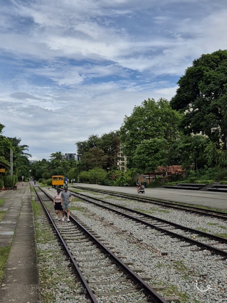
The historic landmark dates back to 1932, and it has been restored and converted into a heritage gallery complete with information plaques. Be sure to check out the nearby Railway Staff Quarters building and the herb garden beside it too.
Trail: Rail Corridor South
Difficulty Level: Easy
- Ease of Walk (18/20 points)
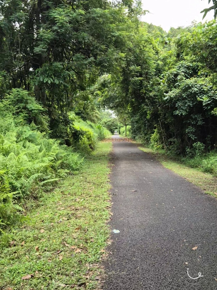
When it comes to technical hiking difficulty, the southern stretch of the Rail Corridor is about as easy as it gets. The entire walk can be completed without having to step off the grippy asphalt trail, which remains flat and even all the way from Holland to Tanjong Pagar.

However, we’re still docking off a couple of points due to the popularity of bikes along the trail. We’d advise keeping your head on a swivel for errant cyclists who don’t adhere to the statutory speed limit of 10kmh.
- Accessibility (17/20 points)
Assuming you’re hiking southwards from Bukit Timah to Tanjong Pagar, the trail passes alongside King Albert Park (DT6) MRT station and later, Buona Vista (CC21/EW21) at about the halfway point, with plenty of obvious (and less-obvious) exit points along the way.
This means that Rail Corridor South is probably the most accessible section of the entire Rail Corridor stretch, save for the final stop near Spooner Road. The hike currently ends at the old KTM railway signalling building, which is about half an hour from the nearest MRT. Thankfully, the Kampung Bahru bus terminal is just a short hop away.
- Amenities (8/15 points)
If you need the toilet often, Rail Corridor South is not for you. There is only one toilet directly connected to the trail, and you’ll find it at the trailhead near King Albert Park MRT. Benches are just as sparse – you’ll treasure every rest break you get along the way.
Our advice? Break trail often and early, especially before you hit the stretch along the AYE (Ayer-Rajah Expressway), as you’ll be heading directly into an industrial area with fewer toilet stops.
- Scenery (12/15 points)
Rail Corridor South pairs long stretches of untouched, verdant greenery with a surprisingly diverse smorgasbord of Singaporean sights. There are fancy Holland Village landed properties, the nostalgic (and soon-disappearing) flats of Tanglin Halt, and biophilic megastructures at Biopolis to boot.
- Weather Protection (4/10 points)
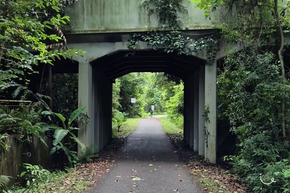
While the overhead trees provide ample shade for most of Rail Corridor South, they don’t do much to stop the rain. There are flyovers to seek shelter under, but they only come about every kilometre or so. Check the weather forecast often, and if dark clouds loom overhead, attempt to head off trail sooner rather than later.
- Navigation (10/10 points)
The trail is one long, straight path. It’s almost impossible to get lost, unless you try to exit through an unmarked path. Otherwise, all the exits are well-demarcated and, especially for this southern stretch, nicely paved.
- Bonus Points (7/10 points)
We give Rail Corridor South extra points for the historic sights you’ll get to see along the way. Assuming you’re heading south, we’d recommend starting your hike with the former Bukit Timah Railway Station before heading down and ending at the old KTM building. Eventually, you’ll get to hike all the way to the old Tanjong Pagar Railway Station after its redevelopment is complete (slated to be done by 31 July 2027).
About SilverStreak’s Walking Guide Scorecard
| SilverStreak Walking Guide Scorecard Rail Corridor South Difficulty level: Easy |
|
|---|---|
| Ease of Walk | 18/20 |
| Accessibility | 17/20 |
| Amenities | 8/15 |
| Scenery | 12/15 |
| Weather Protection | 4/10 |
| Navigation | 10/10 |
| Bonus Points | 7/10 |
| Total Score | 76/100 |
The scorecard rates parks across key categories that matter to visitors, from comfort and safety to the little touches that make a place memorable. Each category is scored to reflect the overall experience.
Ease of Walk: Measures how comfortable and manageable the paths are for strolling, including gradients and surface conditions.
Accessibility: Looks at how accessible the park is to visit via different transport options. Also considers features like railings, ramps, lighting, and barrier-free access for all visitors.
Amenities: Availability of conveniences such as toilets, benches, and food and drink options nearby.
Scenery: Evaluates the park’s atmosphere, greenery, and scenic views that contribute to relaxation.
Weather Protection: Looks at how well the park provides shade, rain shelters, or covered areas.
Navigation: Assesses clarity of maps, directional signs, and ease of finding one’s way around.
Bonus Points: Rewards unique or standout features that give the park added character and appeal.
Total Score: An aggregated score based on all the points above. A higher score indicates a better overall experience.
Difficulty Level: A separate indicator (Easy, Intermediate, or Hard) from the Total Score, used to gauge the overall challenge expected of the walk.
Keen to explore new hiking trails with fellow silvers? Check out our Jalan-Jalan Kakis today!