Rifle Range Nature Park has something for everyone.
Sturdy, anti-slip boardwalks for safe walking even after the rain, wheelchair-accessible paths marked out on the boardwalks, an adventure trail for the kids, a quarry to gaze at, a lookout to peer from, and gravel/earthy hiking trails with ample incline and steps for the seasoned trekker.
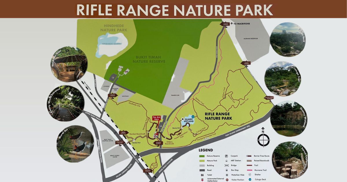
The 66-hectare park is the eighth addition to the central Nature Park network, a ring of nature parks surrounding the Central Catchment and Bukit Timah Nature Reserves.
Seven km of trails are accessible from six entrances to the park.
A carpark with 68 spaces (including two for handicapped parking and 10 bicycle slots) near the Visitors’ Centre makes it very convenient if you have a passenger who has mobility aids.
Advertisement
Link Bridge from Beauty World Centre
I chose to start at the link bridge at level 4 of the Beauty World Centre just a short walk from the Beauty World MRT (Exit A).
There is no F&B outlet at the park so treat yourself at the Hawker Centre on level 4.
Delight in the You Peng Noodle Dumpling House delicacies or queue for the worth-the-wait bowl of TOP 1 Home-made Noodles before heading onto the bridge that leads to the Rambai Boardwalk.
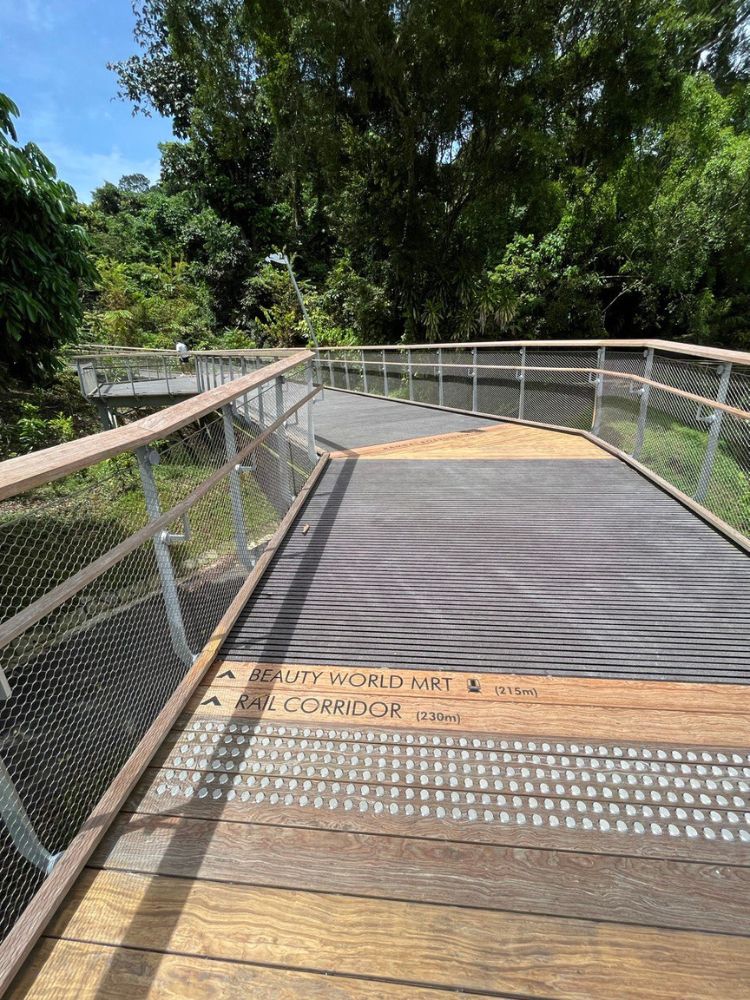
Once on the boardwalk, follow the trail names to reach the highlights.
First up is the Quarry Wetland. The old Sin Seng Granite Quarry was closed in 1998. Formerly, kampong trails skirted the quarry.
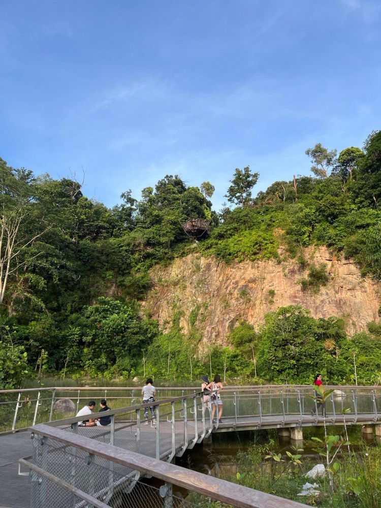
Then the quarry was filled with soil but eventually rainwater collected, turning it into a swamp-like basin.
Today the area has been transformed into a freshwater ecosystem.
You can take in the granite-eroded surface of the outcrop while standing on the viewing platforms or sit in the adjacent nest to watch birds.
Look up and you’ll see an interesting brown wing-shaped deck.
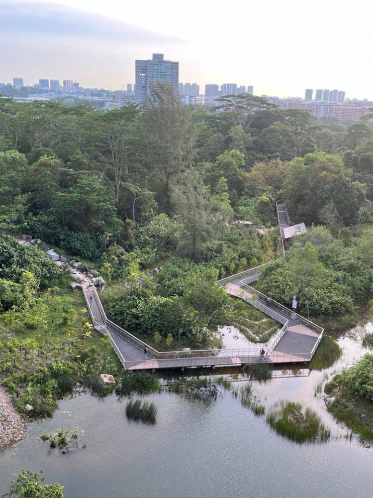
That would be the Colugo Deck situated 31 metres above ground as the perfect vantage point to have a panoramic view of the wetland and the boardwalks.
The design of the Colugo deck is inspired by the patagium of the Malayan Colugo. The patagium is a wing-like membrane that allows the mammal to glide from tree to tree.
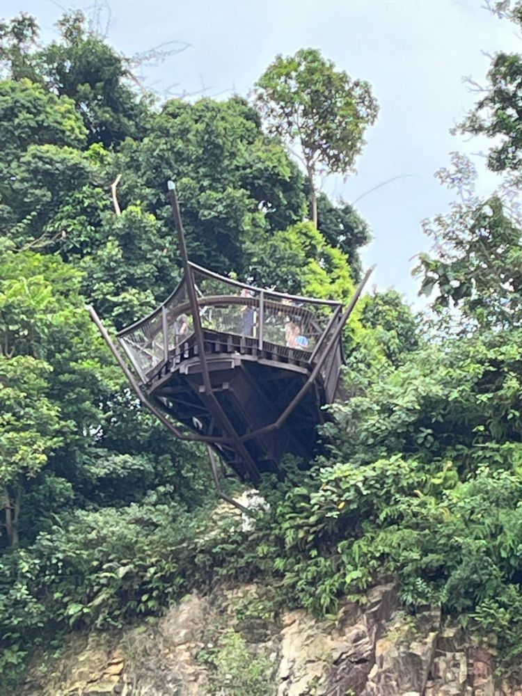
The climb to the deck can be both challenging and a good workout. Opt for either the shorter challenging route or moderate route (50m).
TIP: Try not to go at twilight as your photos may be backlit.
When you descend, take the route to the Murnane Trail.
This will take you to just past the Temasek Club (another food possibility especially the Peranakan attraction, Daisy’s Dream Kitchen).
From here you can proceed for another 2.2km in the direction of MacRitchie.
Stream crossing
Or you can choose the trail with a sense of history.
To my delight, on my fourth trip to the park, I met an experienced guide who told me he grew up in the kampongs at Hindhede and Kampong Chantek.
I asked him about the Durian Loop which I had been trying to access during the pandemic but to no avail as the area was under construction. He solved the puzzle.
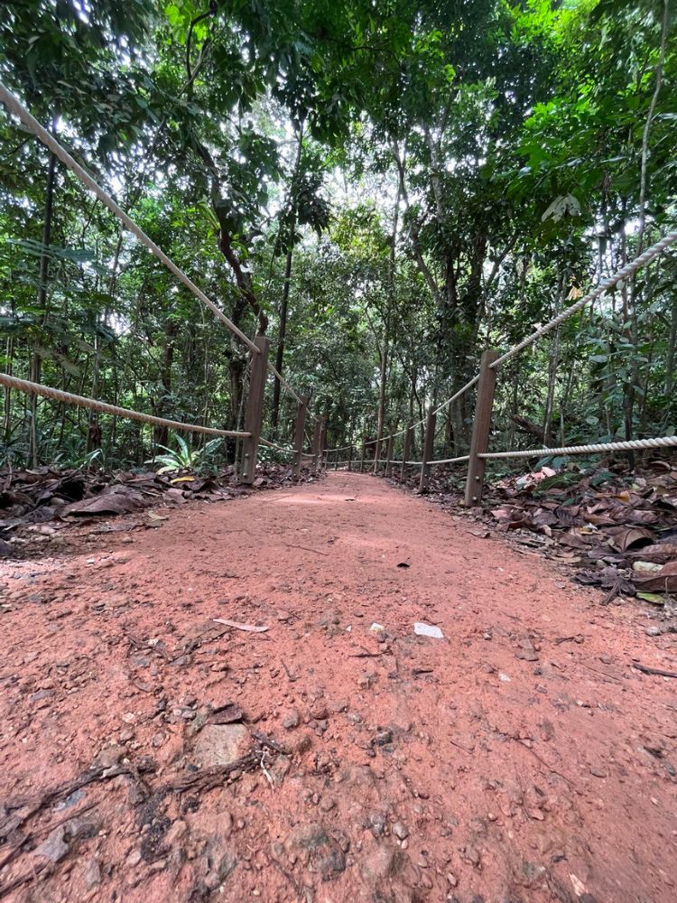
The Durian Loop is now the Gaharu/Banyan Trail. The trees are still standing but the name, sadly, has vanished.
The Kampong Chantek Trail has been completed with a stream to look forward to.
On the Banyan Trail you can experience stepping on huge rectangular flat stones over a freshwater stream flowing from the Bukit Timah Nature Reserve to the Bukit Timah Canal and Marina Barrage.
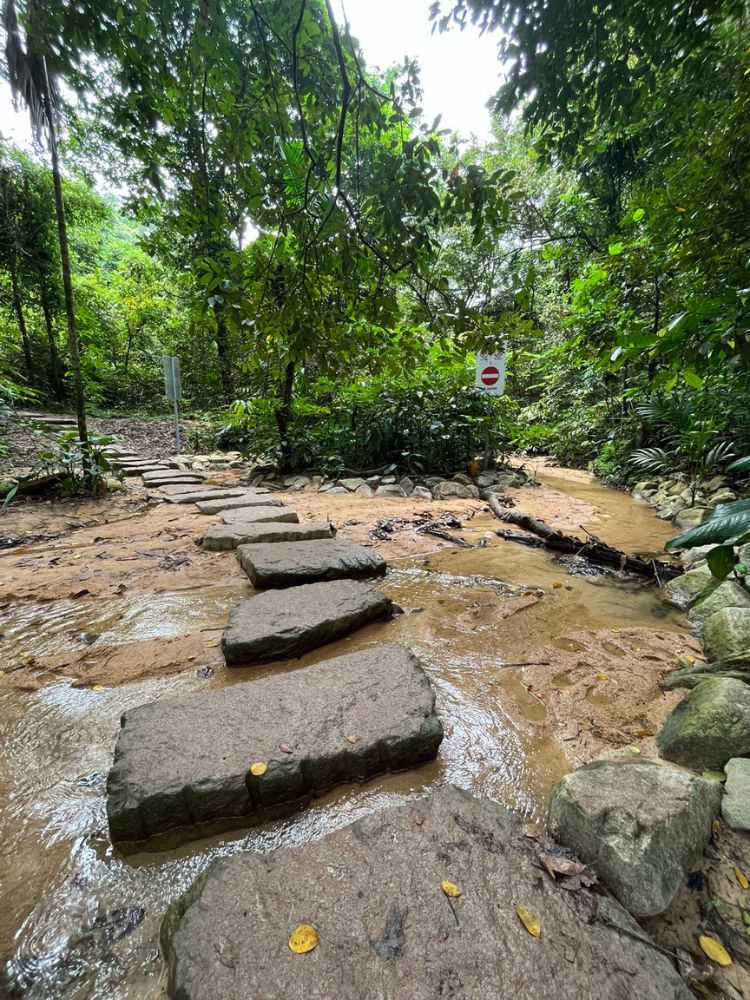
Sometimes the long-tailed Macaques make an appearance when they source clean water.
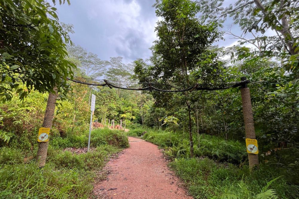
There are also aerial rope bridges that the animals like squirrels, the flying Lemur and long-tailed Macaque use to move around safely.
Seasoned trekkers
The terrain on the Gaharu, Banyan, and Murnane trails attracts trekkers like me who prefer paths less manicured.
I thoroughly enjoyed my peaceful safe trek all the way to the Murnane entrance of the Murnane reservoir.
Previously I had to hike along Rifle Range Road with oncoming traffic which was rather dangerous. All that has changed.
The 1.6km pavement now takes you past the Rifle Range Military Camp and Singapore Technologies.
After that point is the entrance to the MacRitchie Trail; just 2.8km to the Tree Top Walk.
If you are curious about the trail opposite lampost 89 on Rifle Range Road, that is another experience. Called the Pipeline Trail, it takes you to the base of the Bukit Timah Hill climb from the Cave path. Or onward to the Dairy Farm/Zhonghua/Chestnut Parks.
Forest Exploration Trail
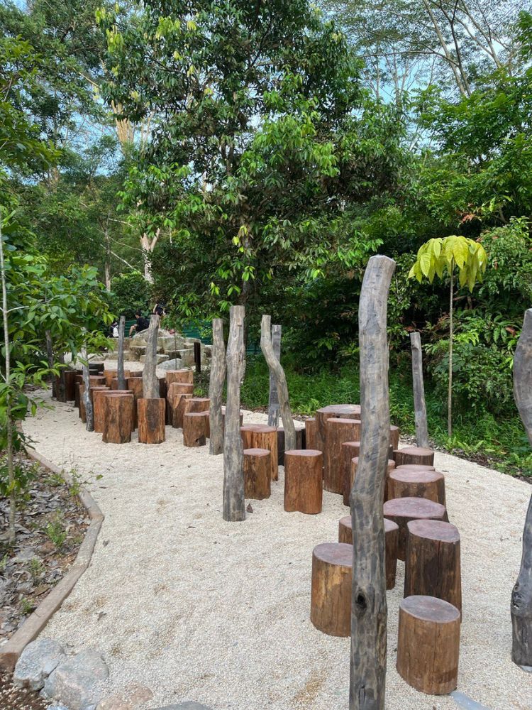
If your grandchildren are walking with you, they will be enthralled and excited on this pebbled pathway taking in lots of interesting bite-sized information, looking out for carvings of animals like squirrels and snakes, honing their balancing skills on an obstacle course of logs (Stepping Stumps) and trying boulder-climbing.
Hindhede entrance to the Rifle Range Park
On another day I chose to start at the Hindhede Trail (on your right as you head to Bukit Timah Hill).
It is a pleasant 750-metre walk and joins the Visitor Centre where you can access the other trails.
The Rifle Range Park connects to the Rail Corridor seamlessly so you can extend your walk if you wish to chalk up more steps.
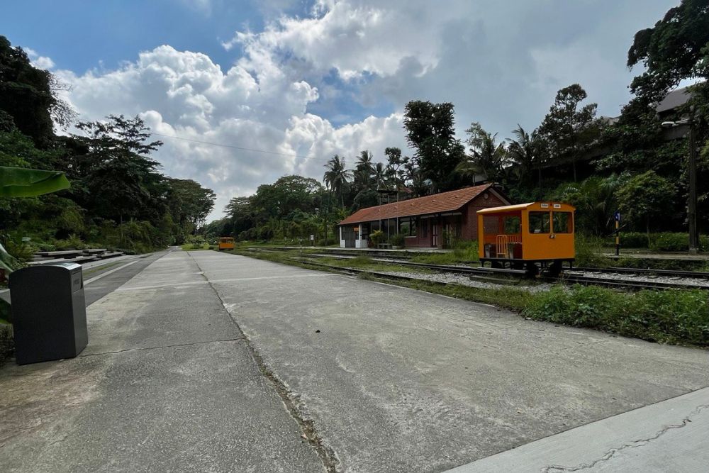
I chose to tie the walk in with a visit to the refurbished Bukit Timah station, part of the Rail Corridor. Lots of info accompanying the pictures of the railway system abound at the gallery.
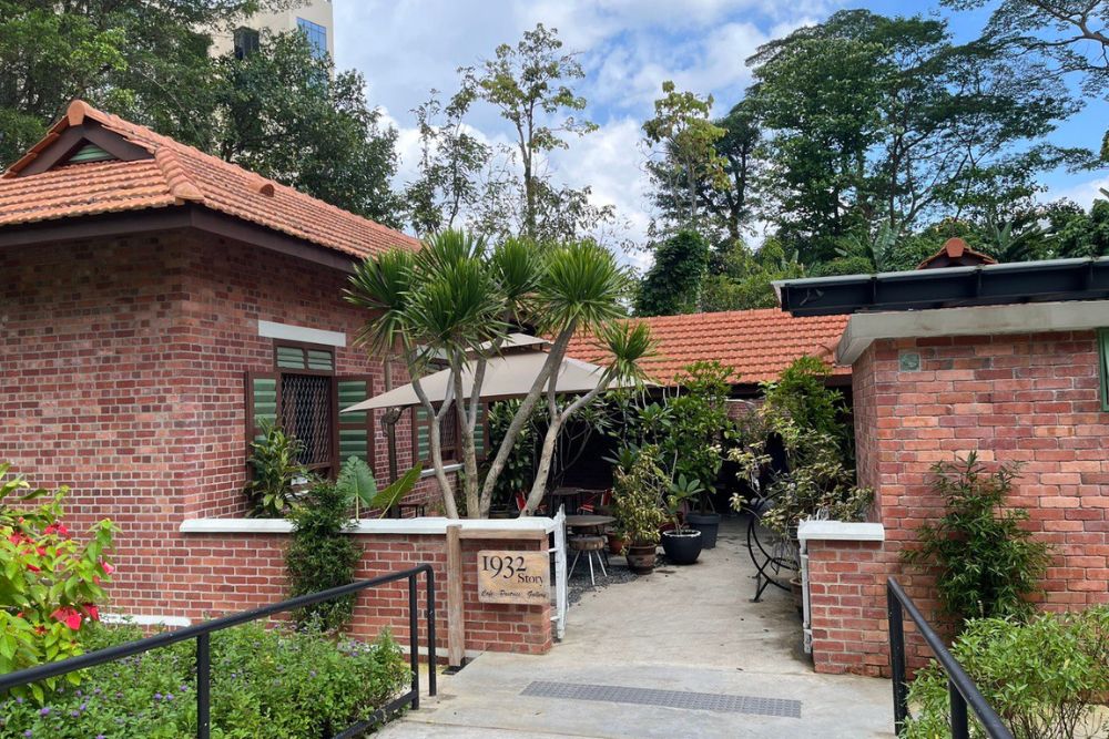
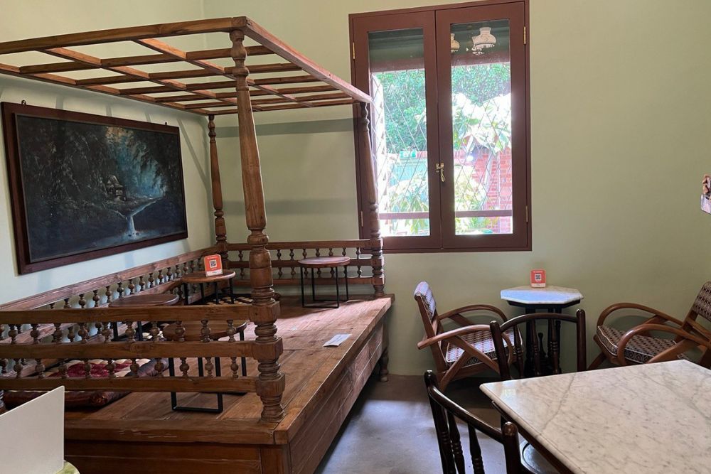
I highly recommend the 1932 Café (formerly the station master’s quarters). The railway line was constructed in 1932. Hence the name.
Like the park which has something for everyone, so to does this café with its thoughtfully-planned menu.
Children have their favourites, and adults can choose from an array of Western, local, small bites, vegetarian and even vegan meals. I am still drooling thinking about the Rendang Pie I had. Heaven.

